
The best trails in the Algarve fall into three distinct landscapes: the honey-coloured cliff coast of the central Barlavento, where the Sete Vales Suspensos route runs (6 km between Praia da Marinha and Vale Centeanes); the rugged western shoreline, crossed by the Rota Vicentina and the Trilho dos Pescadores; and the green hills of Monchique, the one spot in the Algarve where you walk among eucalyptus, chestnut trees and springs at 900 metres of altitude.
This guide organises the routes by area, gives you the real distances and difficulty of each one and points you to where to settle so you step out of the house already on the trail.
What are the best trails in the Algarve?
The best trails in the Algarve cluster into three areas with very different landscapes. In the central Barlavento, the Sete Vales Suspensos route links ochre-cliff beaches between Lagoa and Carvoeiro. In the west, the Rota Vicentina and the Costa Vicentina offer wild, windswept coastline all the way to Sagres. Inland, the hills of Monchique are the only mountain zone, with forest and springs.
The choice depends on what you're after: turquoise-sea views and beaches for a swim along the way point to the Lagoa coast and Lagos; raw nature and solitude point to the Costa Vicentina; shade, cool air and altitude point to Monchique. All have easy stretches and demanding ones, so it's worth knowing the distances before you lace up your boots.
| Trail | Area | Distance | Difficulty |
|---|---|---|---|
| Sete Vales Suspensos | Lagoa / Carvoeiro | ≈ 6 km (one way) | Moderate |
| Trilho dos Pescadores (Rota Vicentina) | Costa Vicentina / Sagres | Several sections of 9–22 km | Moderate to hard |
| Caminho Histórico (Rota Vicentina) | Western interior | Stages of 14–25 km | Moderate |
| Climb up to Fóia | Serra de Monchique | Routes of 4–10 km | Moderate to hard |
| Ponta da Piedade (boardwalks) | Lagos | ≈ 3 km (there and back) | Easy |
| Ria Formosa routes | Faro / Olhão / Tavira | 2–8 km, flat | Easy |
Whatever the trail, the pattern repeats: you walk the cliffs or hills in the morning and end the day in the sea or at the table. That's why the home's location matters so much — staying near the starting point saves you the first hour of driving each day.
What is the Sete Vales Suspensos trail like?
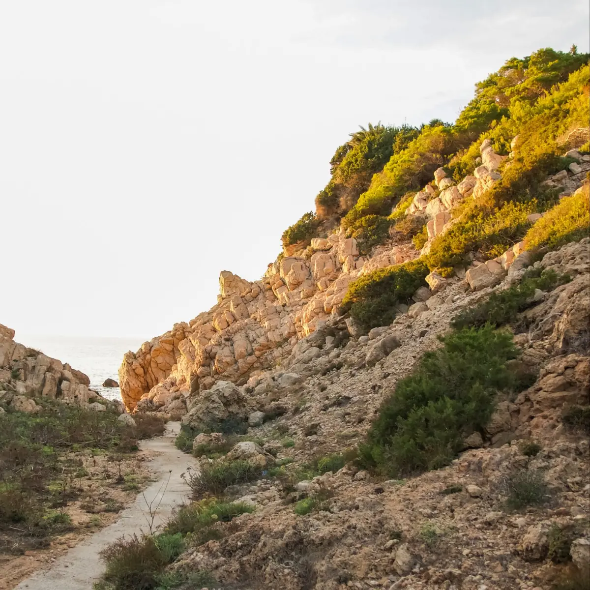
The Sete Vales Suspensos trail is about 6 km one way and links Praia da Marinha to Praia de Vale Centeanes, in the municipality of Lagoa. It is the best-known coastal route in the Algarve and crosses, as the name says, seven small valleys cut into the cliff, with constant climbs and descents — hence the moderate difficulty rating despite the short distance.
The path passes viewpoints over famous rock formations, including the natural arch near the Marinha and the view of the Benagil cave. It isn't circular: either you arrange transport between the two ends, or you walk there and back (roughly 12 km in total). As it runs along the top of the cliff, there are stretches with no railing and no shade, so bring water, sturdy footwear and keep an eye on the children.
How to reach the starting point
The simplest access is from Praia da Marinha, with a car park at the top of the cliff. The Marinha is a few minutes' drive from Carvoeiro and Armação de Pêra, and about 44 km from Faro Airport via the village of Carvoeiro. The complete guide to Praia da Marinha details opening times, parking and the best hours to avoid the crowds.
For those who walk the trail in late afternoon, it's worth finishing at Vale Centeanes or returning to the Marinha in time for sunset — the low light over the ochre rock is the best moment of the day to photograph this stretch.
Is it worth hiking the Rota Vicentina and the Trilho dos Pescadores?
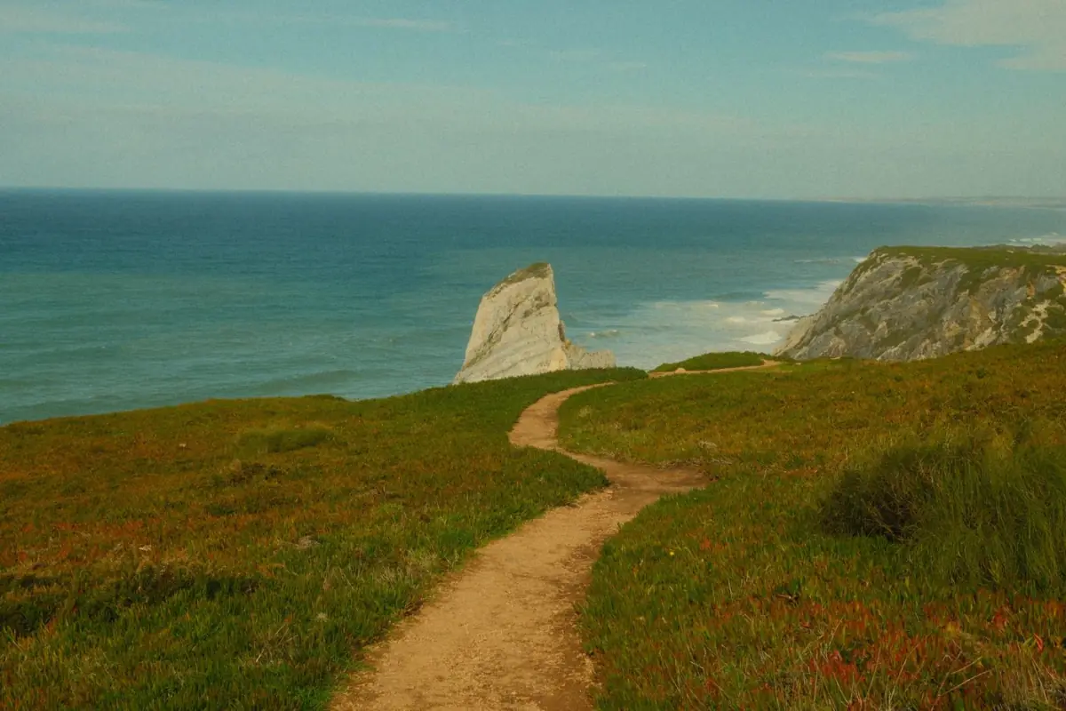
It is, if you're after raw nature rather than beaches for a swim. The Rota Vicentina is a network of long-distance walking routes that links the Alentejo coast to Cabo de São Vicente, in Sagres — the southwesternmost point of mainland Europe. It crosses the Parque Natural do Sudoeste Alentejano e Costa Vicentina, one of the least built-up stretches of coast in the country.
Within the network, the Trilho dos Pescadores is the most spectacular: it hugs the cliff edge, often over sand and rock, along the old paths the fishermen used to reach their fishing spots. Because it runs over sandy ground exposed to the Atlantic wind, it is physically harder than it looks on the map — it's rated moderate to hard. The stages vary, but run from around 9 to 22 km each.
Sagres and Odeceixe as gateways
Sagres, in the municipality of Vila do Bispo, is the natural base for the southern tip of the route; it sits about 87 km from Faro Airport, which makes it the most distant and wildest village in the Algarve. Further north, already in the municipality of Aljezur, Odeceixe (85 km from Faro, with just over a thousand inhabitants) marks the border with the Alentejo, and its river-and-sea beach is one of the most sought-after on the west coast.
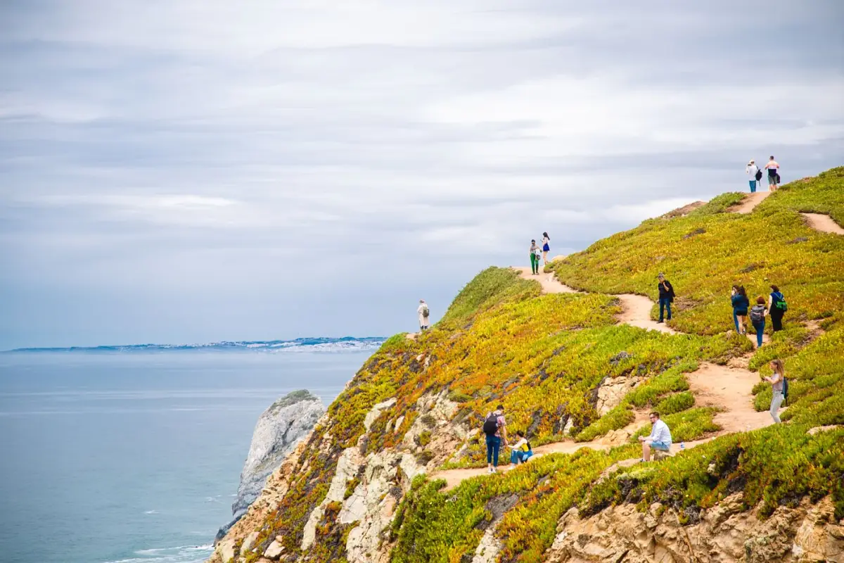
Those who walk here trade the comfort of postcard beaches for the feeling of having the ocean all to themselves. Even in summer, the Costa Vicentina is windier and cooler than the south, which makes it walkable almost all year — as long as you respect the wind and the lack of shade.
What are the hikes in the Serra de Monchique like?
Hiking in Monchique is the Algarve's only mountain experience. The hills rise behind Portimão and culminate in the Fóia, the highest point in the region, at around 900 metres of altitude and with a view that on a clear day reaches the Lagos coast and the Serra de Sintra. The municipality of Monchique lies about 65 km from Faro Airport and has just over six thousand inhabitants.
Here you walk among eucalyptus, chestnut trees, strawberry trees and water springs — a green landscape that contrasts completely with the coast. The routes start from the village of Monchique and from Caldas de Monchique, and range from short 4 km walks to climbs up the Fóia that exceed 10 km. The altitude brings milder temperatures in summer, making this the best escape when the heat builds on the coast.
What to combine with the hike
- The Caldas de Monchique, a historic thermal spa tucked into a wooded valley, to end the day in warm waters.
- The medronho and local cured meats, products of the hills sampled in the village taverns.
- The Fóia viewpoint, with the widest view in the Algarve over both coasts.
- A descent to Portimão or Alvor to head back to the beach in the late afternoon.
Monchique works best as a counterpoint: one or two days in the hills in the middle of a week at the beach are enough to completely change the rhythm of the holiday without leaving the Algarve.
What easy walks are there for families with children?
For families with children, the best walks are the flat, short ones by the sea, without the climbs and sheer drops of the big trails. The most accessible are the boardwalks and pedestrian paths that keep you away from the cliff edge, and the Ria Formosa trails, which are entirely flat.
Three calm options with children
- Ponta da Piedade boardwalks, in Lagos — about 3 km there and back over the most beautiful cliffs in the Barlavento, with an optional stairway down to the sea.
- Ria Formosa routes — flat paths between salt marsh and salt pans in Faro, Olhão and Tavira, ideal for spotting birds and flamingos.
- Short Marinha section — a small excerpt of the Sete Vales route, with viewpoints right at the start, without doing the full 6 km.
The rule with children is simple: choose routes that start and end in the same place, take plenty of water and work out the way back before setting off. Those travelling as a family will find more ideas in the Algarve with children guide and in the things to do beyond the beach.
With these options, even those travelling with small children can get real contact with the Algarve landscape without turning the walk into an endurance test.
When is the best time to hike in the Algarve?
The best time to hike in the Algarve is spring and early autumn, outside the peak heat — from March to June and from September to November. In these months the air temperatures are mild, the coastal trails are green and there are fewer people on the routes than at the height of summer. Spring has the added bonus of wildflowers on the cliffs and in the hills.
Summer is the worst time for exposed trails, especially the shadeless coastal ones and those of the Costa Vicentina. Walking between 11 am and 5 pm in July and August is risky because of the heat and the radiation. If you can only go in summer, set off very early in the morning or in the late afternoon, and give priority to Monchique, where the altitude cools the air. The Algarve off-season guide shows why the mild winter is also an excellent time to walk, with gentle days and empty beaches.
| Season | Conditions | Recommended trails |
|---|---|---|
| Spring (Mar–Jun) | Mild, green, in bloom | All — the ideal season |
| Summer (Jul–Aug) | Strong heat, no shade | Monchique and only early morning |
| Autumn (Sep–Nov) | Mild, fewer people | Coast and Costa Vicentina |
| Winter (Dec–Feb) | Gentle, short days, some rain | Coast on dry days |
Whatever the month, always set off with enough water, firm-soled footwear and sunscreen — in the Algarve, even on cool days, the glare off the sea and the pale rock burns the skin faster than you'd expect.
Where to stay near the Algarve's trails?
The best base for hiking in the Algarve is Lagos, in the Barlavento: it combines the coastal boardwalks of Ponta da Piedade with access to the Costa Vicentina and Sagres, and offers town, dining and beaches all at once. Lagos sits 63 km from Faro Airport and has around 31,000 inhabitants, which makes it lively without losing its village feel. For the Sete Vales Suspensos, Carvoeiro and the Lagoa area are more convenient.
Those who want to step out of the house already kitted out for a day on the trail gain from renting a home with space and its own outdoor area — to dry boots, store backpacks and relax by the pool at the end of the day. In Lagos our inventory includes options such as a 5-bedroom villa of 492 m², ideal for groups of hikers, and two 3-bedroom apartments with a pool (of 121 m² and 150 m²) a short distance from the coastal routes and the marina.
Real-time availability and prices on Homing — book direct, cheaper than Booking, Airbnb and Hotels.com. Click «See dates and price».
Booking these homes direct on Homing comes out cheaper than on Booking, Airbnb or Hotels.com: there's no platform commission or hidden fees, and support is in Portuguese, English, French and Spanish. You can compare the advantages of direct booking against Booking and Airbnb before deciding, and see the whole range of villas and apartments available.
For those who prefer the calmer Sotavento, Tavira gives access to the flat Ria Formosa routes and the barrier islands — a completely different kind of walking, without cliffs but with the light and the birds of the lagoon.
What rules and precautions should you follow on the trails?
The golden rule on the Algarve's coastal trails is to never lean over the cliff edge. The limestone rock is unstable and collapses, and there is signage advising you to keep your distance at several points along the Lagoa and Lagos coast. Always stay on the marked path and inside the railings, especially near Benagil and the Marinha.
- Take enough water: most coastal trails have no fountains or shade.
- Wear firm-soled footwear; many surfaces are loose sand or rock.
- Check the wind and the tide on the Costa Vicentina before heading down to enclosed beaches.
- Respect the Natural Park on the Costa Vicentina and in Monchique — don't leave the trails or drop litter.
- At the Benagil cave, access by land is restricted; check the current rules in the guide on how to visit Benagil.
With these precautions, the Algarve's trails are safe and accessible to most people. What separates a good day's walk from a bad one is planning: knowing the distance, the departure time and the way back before you start, and not improvising shortcuts across the cliff.
Sources and references
- Rota Vicentina — Associação Rota Vicentina — https://rotavicentina.com/
- Turismo do Algarve (Visit Algarve) — https://www.visitalgarve.pt/
- ICNF — Parque Natural do Sudoeste Alentejano e Costa Vicentina — https://www.icnf.pt/
- IPMA — Instituto Português do Mar e da Atmosfera — https://www.ipma.pt/
- Wikipedia — Serra de Monchique — https://pt.wikipedia.org/wiki/Serra_de_Monchique
- Wikipedia — Costa Vicentina — https://pt.wikipedia.org/wiki/Costa_Vicentina
Original editorial article by Maré Algarve, based on official sources (Turismo do Algarve, ICNF, ABAE/Blue Flag, IPMA, INE) and on our experience of holiday rentals in the Algarve. Prices and availability vary — always check each property's page.